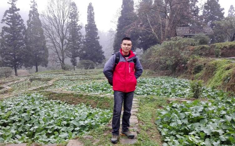
黄登红,1990年生,硕士生导师,高级实验师,2017年至今在贵州师范大学工作。主要研究方向:无人机山地遥感、喀斯特山区LULC遥感智能解译等。主持完成贵州省基金项目、毕节市科技项目,主持在研省科技支撑计划项目,参与国家重点研发计划项目、国家自然科学基金、省重大专项和省市县社会服务项目等40余项,合作发表论文70余篇,授权发明专利4项、计算机软件著作权2项。
招生方向:地图学与地理信息系统(无人机遥感、LULC遥感智能解译、WebGIS开发)
风景园林
E-mail:hdh@gznu.edu.cn
1、主持和参与项目
[1] 贵州省科学技术基金项目,高原山区特色农作物超低空遥感特征构建与识别方法研究,主持,结题.
[2] 贵州省科技支撑项目,基于乡村振兴的石漠化治理生态产业云平台建设关键技术研究,主持,在研.
[3] 贵州省典型高原湿地保护与修复重点实验室开放基金项目,遥感大数据支持下的喀斯特高原草海湿地生态系统服务演变机制与评价,主持,结题.
[4] 国家重点研发计划项目专题,面向专题的城镇时空信息获取处理系统,参加,结题.
[5] 贵州省教育厅农业科技支撑项目, 喀斯特山区特色优势水果种植多源遥感监测与产业决策支持研究,参加,结题.
[6] 贵州省科技计划工业攻关项目,基于北斗卫星的山地高效农业产业园区智能管理系统开发与应用,参加,结题.
[7] 贵州省重大科技专项专题,贵州省茶叶、蔬菜产地土壤质量安全评价系统研究,参加,结题.
[8] 贵州省重大科技专项专题,贵州省食用菌质量安全空间管理信息系统构建研究,参加,结题.
2、代表性论文
[1] Huang D, Zhou Z*, Zhang Z, et al. Extraction of agricultural plastic film mulching in karst fragmented arable lands based on unmanned aerial vehicle visible light remote sensing [J]. Journal of Applied Remote Sensing, 2022, 16(3): 0365111-03651124. (SCI四区)
[2] Huang D, Zhou Z*, Zhang Z, et al. Recognition and counting of pitaya trees in karst mountain environment based on unmanned aerial vehicle RGB images[J]. Journal of Applied Remote Sensing, 2021, 15(4): 0424021-04240224. (SCI四区)
[3] Du X, Huang D*, Dai L, et al. Recognition of Plastic Film in Terrain-Fragmented Areas Based on Drone Visible Light Images[J]. Agriculture-Basel, 2024, 14(5): 736. (SCI二区)
[4] Huang D, Zhou Z*, Zhang Z, et al. Land Use/Land Cover Remote Sensing Classification in Complex Subtropical Karst Environments: Challenges, Methodological Review, and Research Frontiers[J]. Applied Sciences-Basel, 2025, 15(17): 9641. (SCI四区)
[5] 黄登红,周忠发*,彭睿文,等.西南高原山区作物低空遥感挑战与主要研究进展——以贵州省为例[J]. 贵州师范大学学报(自然科学版), 2021, 39(5):53-61.(CSCD)
[6] 黄登红,周忠发*,吴跃,等. 基于无人机可见光影像的高原丘陵盆地区山药植株识别[J]. 热带地理, 2019, 39(4): 571-582. (CSCD)
[7] 黄登红,周忠发*,黄智灵,等. 黔东山区茶产地土壤重金属污染建模评价研究[J]. 重庆师范大学学报:自然科学版, 2017, 34(2): 107-112. (北大核心)
[8] 黄登红,周忠发*,王历,等. 贵州省生态保护红线云GIS监管平台研究与实现[J]. 现代电子技术, 2018, 41(8): 87-91. (北大核心)
[9] 黄登红,周忠发*,牛颖超,等. 高原山区城市遥感大数据云平台构建研究—以贵阳市为例[C]. 系统工程理论与应用—贵州省系统工程学会第七届学术年会论文集. 贵阳, 贵州大学出版社. 2017, 259-265.
[10] Zhu M, Zhou Z*, Huang D, et al. Extraction method for single Zanthoxylum bungeanum in karst mountain area based on unmanned aerial vehicle visible-light images[J]. Journal of Applied Remote Sensing, 2021, 15(2): 026501. (SCI四区)
[11] Du S, Zhou Z*, Huang D, et al. Evaluation of Habitat Quality in Karst Mountainous Areas of Guanling County Based on InVEST and MGWR Models[J]. Land, 2025, 14(7): 1-22. (SCI三区)
[12] Dai Q, Zhou Z*, Huang D, et al. Response of land cover to multi-scale spatial effects in complex karst mountainous areas[J]. Geocarto International, 2025, 40(1): 2513520. (SCI四区)
[13] Yang Y, Zhou Z*, Huang D, et al. A comparative analysis of the applicability of typical land cover datasets in the karst strongly heterogeneous terrain in Southern China[J]. Geocarto International, 2024, 39(1): 2395318. (SCI四区)
[14] Du X, Zhou Z*, Huang D. Influence of Spatial Scale Effect on UAV Remote Sensing Accuracy in Identifying Chinese Cabbage (Brassica rapa subsp. Pekinensis) Plants[J]. Agriculture-Basel, 2024, 14(11): 1871. (SCI二区)
[15] Dong F, Zhou Z*, Huang D, et al. Spatial–Temporal Variation and the Influencing Factors of NO2 Column Concentration in the Plateau Mountains of Southwest China[J]. Atmosphere, 2024, 15(11): 1263. (SCI四区)
[16] Du S, Zhou Z*, Huang D, et al. The Response of Carbon Stocks to Land Use/Cover Change and a Vulnerability Multi-Scenario Analysis of the Karst Region in Southern China Based on PLUS-InVEST[J]. Forests, 2023, 14(12): 2307. (SCI二区)
[17] Zhang F, Zhou Z*, Huang D. Dynamic monitoring and analysis of factors influencing ecological quality in rapidly urbanizing areas based on the Google Earth Engine[J]. Geocarto International, 2023, 38(1): 2256299. (SCI四区)
[18] Zhang Z, Xiong K*, Huang D. Natural world heritage conservation and tourism: a review[J]. Heritage Science, 2023, 11(1): 55. (SCI一区)
[19] Zhang Z, Xiong K*, Huang D, et al. Spatial Zoning of the Value Realization Models for Ecological Products in Shibing Karst Natural World Heritage Site. Forests. 2023; 14(7):1449. (SCI二区)
[20] Zhang, J, Zhou, Z*, Huang, D. Extraction of Impermeable Surfaces Based on Multi-Source Nighttime Light Images of Different Geomorphological Partitions[J]. Applied Sciences-Basel, 2023, 13, 3006. (SCI四区)
[21] Li Q, Yan L, Huang D, et al. Construction of a small sample dataset and identification of Pitaya trees (Selenicereus) based on UAV image on close-range acquisition[J]. Journal of Applied Remote Sensing, 2022, 16(2): 024502. (SCI四区)
[22] Sun Y, Zhou Z*, Huang D, et al. The Spatial and Temporal Evolution Pattern and Transformation of Urban–Rural Construction Land in Karst Mountainous Areas: Qixingguan District of Guizhou, Southwest China[J]. Land, 2022, 11(10): 1734. (SCI三区)
[23] Wang Y, Zhou Z*, Huang D, et al. Identifying and Counting Tobacco Plants in Fragmented Terrains Based on Unmanned Aerial Vehicle Images in Beipanjiang, China[J]. Sustainability, 2022, 14(13): 8151. (SCI四区)
[24] 王小宇,周忠发*,黄登红,等. 喀斯特山区茶园土壤重金属污染损失率模型评价研究[J]. 环境工程, 2018, 36(3): 169-175. (北大核心)
[25] Li Q, Zhou Z*, Huang D, et al. Extraction of Complex Buildings in the Karst Mountains Based on U-Net Deep Learning Model[C]. 2022 3rd International Conference on Geology, Mapping and Remote Sensing (ICGMRS). IEEE, 2022: 127-138. (EI检索)
[26] 张珍珍,熊康宁*,黄登红. 近 30 年来梵净山植被覆盖时空变化及影响因素分析[J]. 水土保持研究, 2018 (2): 183-189. (CSCD)
[27] 蒋翼,周忠发*,黄登红. 黔中水利枢纽区植被覆盖度时空变化及驱动力分析——以平坝为例[J]. 水土保持研究, 2018, 25(6): 221-227. (CSCD)
[28] 尹林江,周忠发*,黄登红,等. 基于无人机影像匹配点云数据的喀斯特峡谷区火龙果单株提取研究[J]. 浙江农业学报, 2020, 32(6):1092. (CSCD)
[29] 张扬,周忠发*,黄登红,等. 喀斯特山区耕地时空演变与影响因子分析[J]. 农业工程学报, 2020, 36(22):266-275. (EI)
[30] 闫利会,周忠发*,黄登红,等. 基于Landsat 8的喀斯特峰丛洼地地貌信息提取[J]. 科学技术与工程, 2018, 28. (北大核心)
[31] 彭睿文,周忠发*,黄登红,等.基于多因子分析的高原山区火龙果种植适宜性评价[J]. 中国农业资源与区划,2022,43(09):179-188. (CSCD/CSSCI)
[32] 尹林江,周忠发*,黄登红,等. 基于云GIS的食用菌质量安全空间管理信息系统设计[J]. 现代电子技术, 2022, 45(06):93-98. (中文科技核心)
[33] 杨莎莎,周忠发*,黄登红,等. FAST电磁波宁静区遥感监测系统研究[J].地理信息世界,2021,28(02):115-119.(中文科技核心)
[34] 王小宇,周忠发*,黄登红,等.贵州省农业资源海量信息管理平台设计研究[C].系统工程理论与运用—贵州省系统工程学会第七届学术年会论文集.贵阳,贵州大学出版社.2017,003-008.
[35] Niu Y, Zhou Z*, Huang D, et al. Application of different composite index methods in the evaluation of soil heavy metal pollution[C]. International Conference on Geo-Informatics in Resource Management and Sustainable Ecosystem. Springer, Singapore, 2016: 43-50.(EI)
3、代表性软著/专利
(1)软件著作权
[1] 黄登红,周忠发,杜先丹,黎前霞.喀斯特山区作物低空遥感样本管理系统.软著登字第13048355号. 2024.05.13.
[2] 黄登红,周忠发,吴跃,王小宇,朱孟,赵馨.喀斯特山区低空遥感地物数据采集系统.软著登字第3319288号. 2018.12.07.
(2)专利
[1] 黄登红,周忠发,尹林江,朱孟,彭睿文.基于无人机遥感的高原山区成熟火龙果实识别与计数方法. 2024.04.26.(发明授权).
[2] 黄登红,周忠发,张付显梅,邓芳芳,杨月,杜双龙,罗亦宁,董飞,代青青.一种基于地理信息数据的生态环境监测方法及系统. 2024.08.16. (发明授权).
[3] 黄登红,周忠发,彭睿文,张珍珍,黎前霞,黄有燕,杜先丹.基于无人机影像的彩钢板建筑识别方法.2024.09.10. (发明授权).
一审(校):黄登红; 二审(校):邓琴; 三审(校):朱大运

